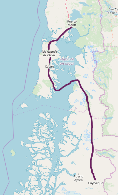
To escape from the hot Christmas1 that struck Santiago on 2018, Karen ❤️ and I went to Chile’s southern region. The plan was to go to Chiloé from Puerto Montt to then return to the mainland to Chaitén and then keep going South until Coyhaique.
Day 0: From Puerto Montt to Castro
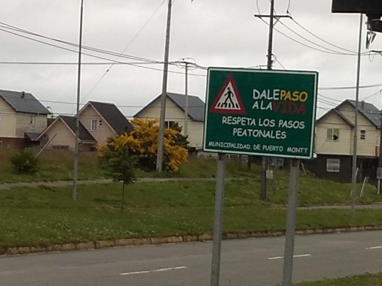
Once we arrived to Puerto Montt2, we took a van from the Airport to the Bus Station. Evn though I heard negative comments about Puerto Montt, I didn’t think it could be that bad, until I spotted a Town Hall signboard using Comic Sans.
From the Station, we took a bus to Castro3, the biggest city in Chiloé island4. The bus crosses the Chacao Channel5 over a ferry, but I mostly didn’t notice, as I was asleep most of the way. After arriving to Castro and finding where to stay, we went for a stroll and we searched a place for lunch. The place we picked didn’t seem to have vegetarian options, so I ordered salad and french fries, but another waitress told the one who took our order to ask if I were vegetarian, after noticing the strange combo I ordered, and then offered vegetables lasagna.
Day 1: Muelle de las Almas and Cucao National Park
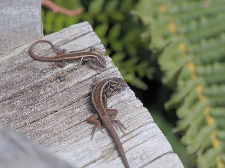
The next day, we started our trip to the Muelle de las Almas (Harbor of Souls)6. The trip from Castro to the Muelle is done in two parts: the first one is done in a bus to the Cucao entrance to the Chiloé National Park7 and the second one is done on a van. Since the van driver wanted to wait for another bus, we did a quick walk to the National Park. On the little time we had, we got to a wooden lookout, where two small lizards were taking a morning sunbath.
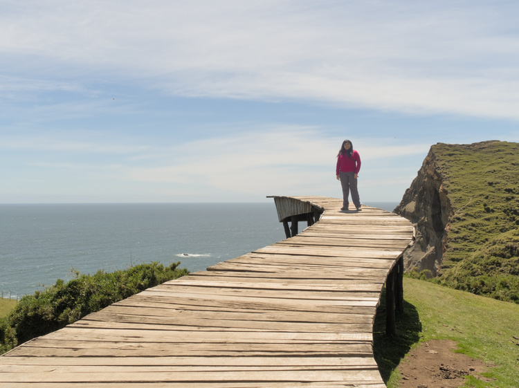
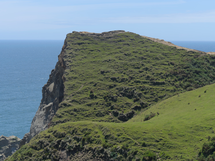
Muelle de las Almas is an installation built by chilean artist Marcelo Orellana Rivera inspired by the Huilliche legend of Cucao’s souls. To cross to the Otherworld, the wandering souls must beg ¡balseo! (ferry!) to the Tempilcahue to get transported8. To get to the Muelle itself, one must hike for about two kilometers from the parking lot.
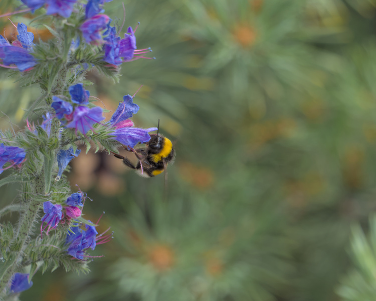
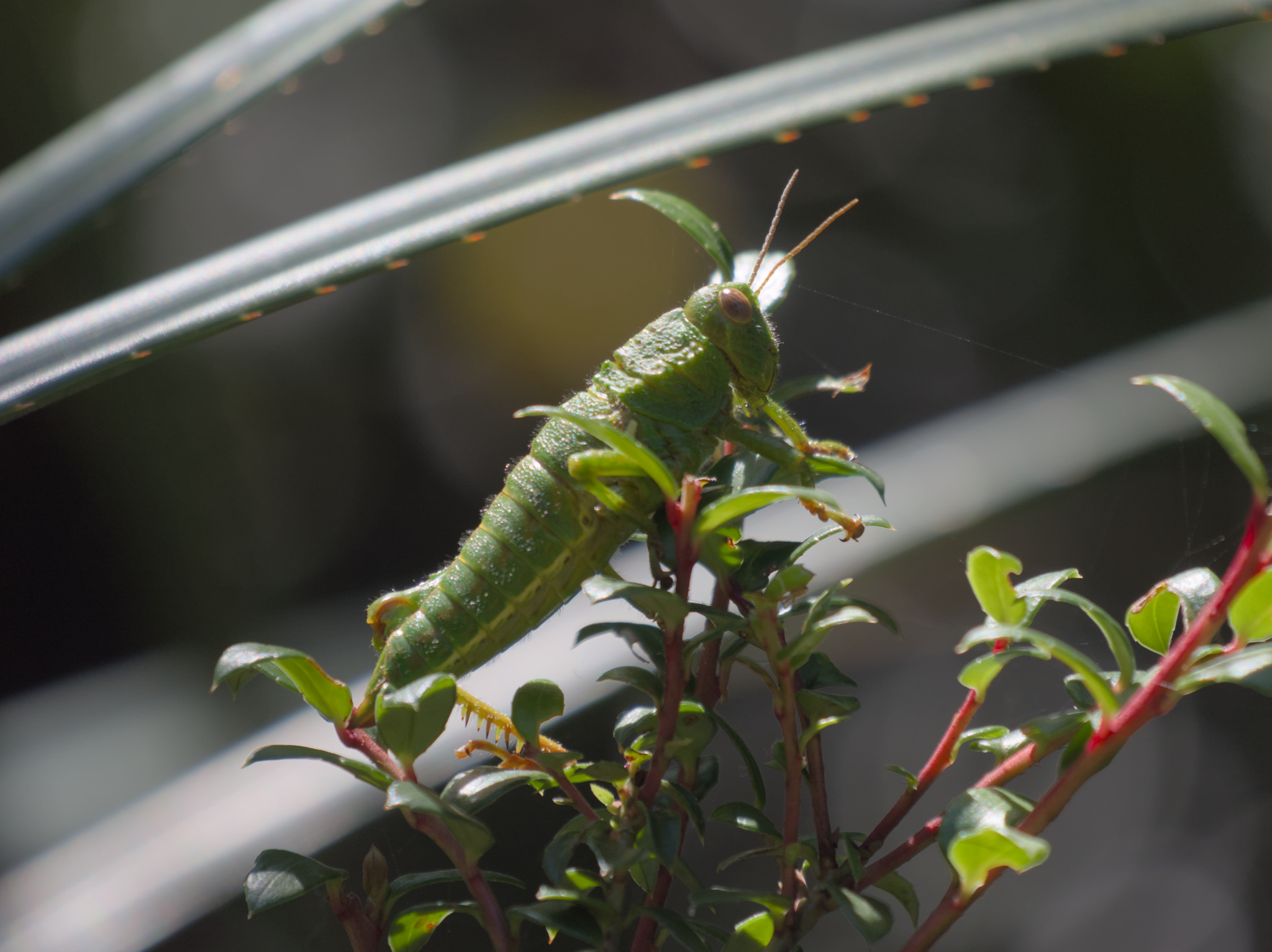
On our way back, we saw a group of people watching closely a grasshopper, and so we did.

With more time in our hands, we walked in the El Tepual trail on the Chiloé National Park. Tepú9 are native trees from southern Chile and Argentina which form forests called tepuales. In those forests, the roots from tepues grow interleaved, forming a fake floor covered by moss and bindweed.
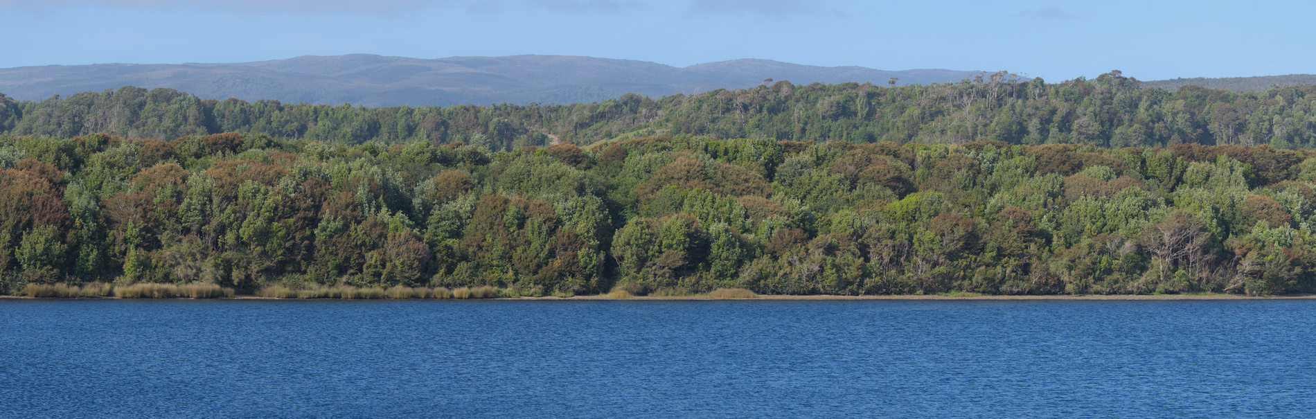
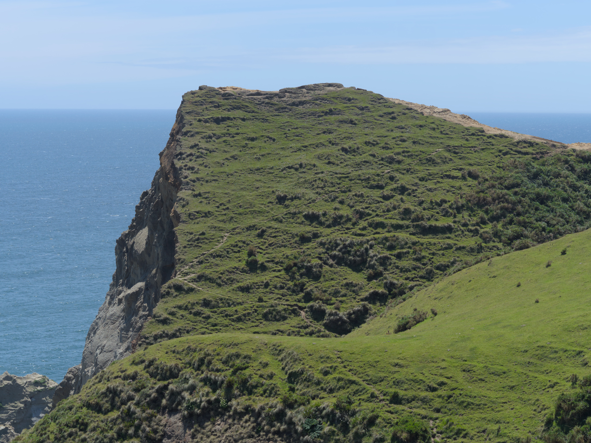
We also walked on some of the shorter trails that are close the Park entrance, as the Los Quiles trail, from where I took a photo of Cucao Lake.
When we were leaving the park, we realized they had already closed their main door, so we had to leave passing through some opening in the fence.
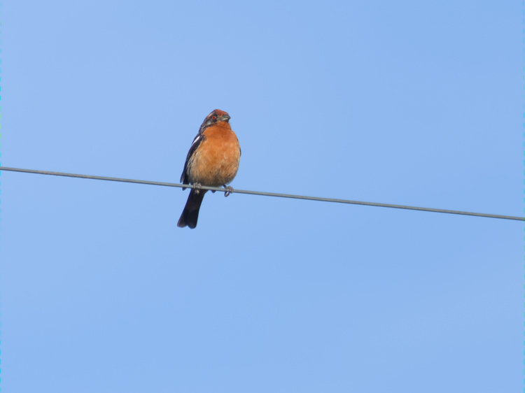
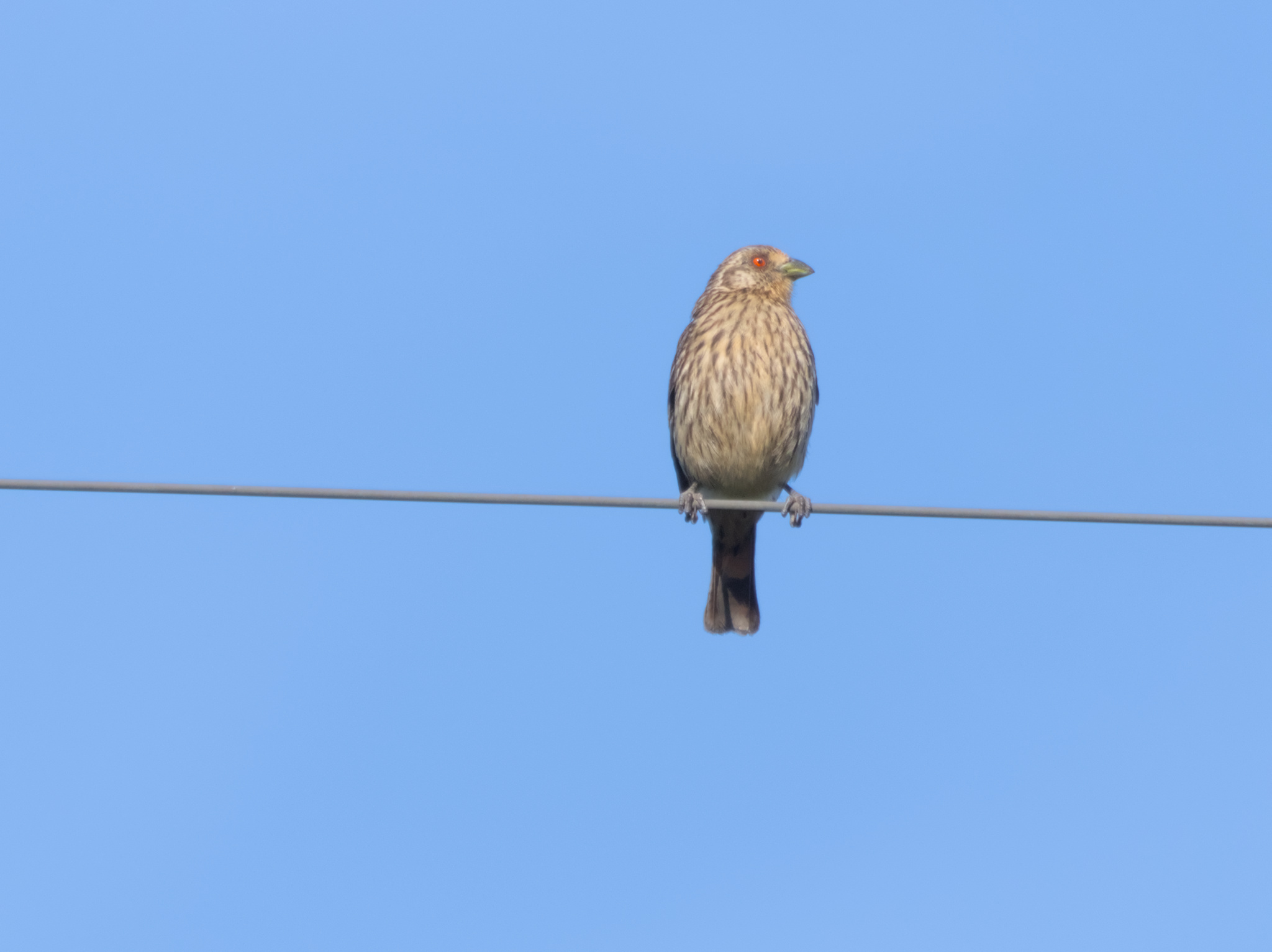
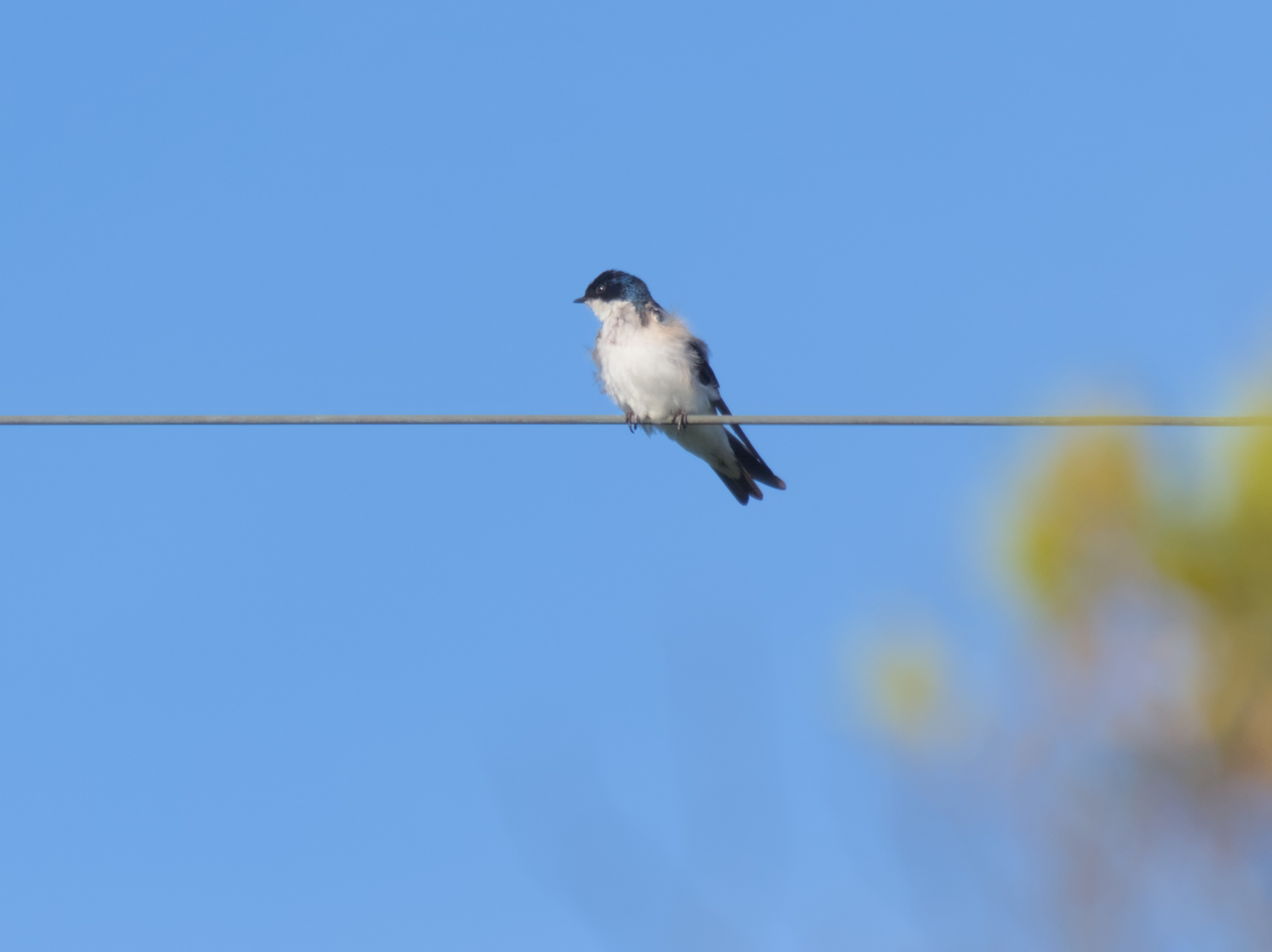
While we waited for the bus that would take us back to Castro, we watched the birds that perched outside the park.


Day 2: Dalcahue, Curaco de Vélez and Achao
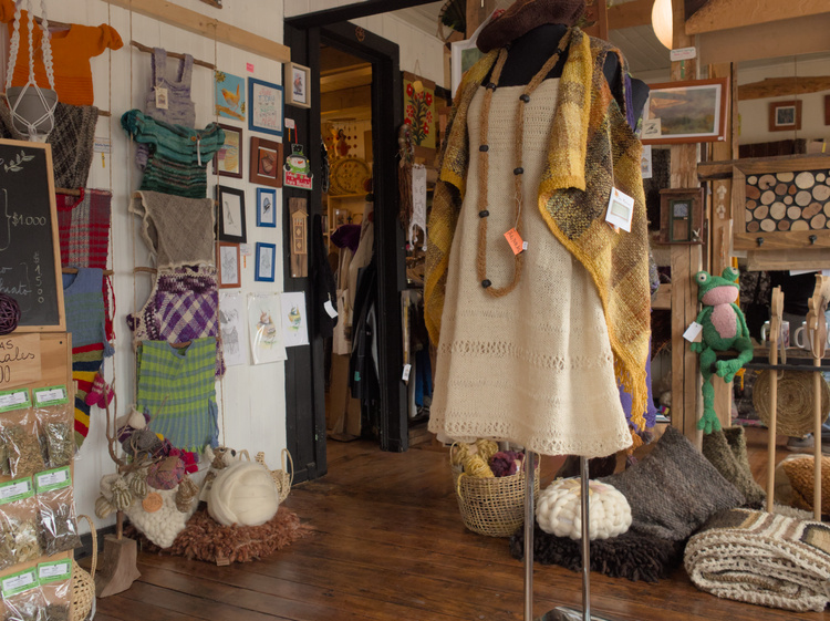
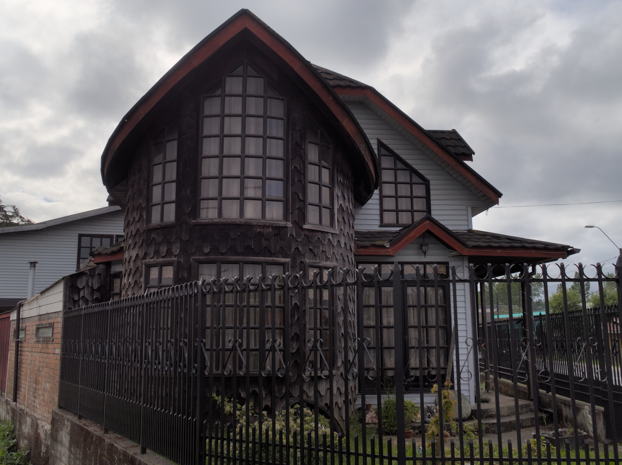
We started the day by visiting Dalcahe10, which means place of dalcas11 in mapudungun. After visiting the local crafts market, we ended up in the small shop/cafeteria ran by the DecoCalen12 collective.
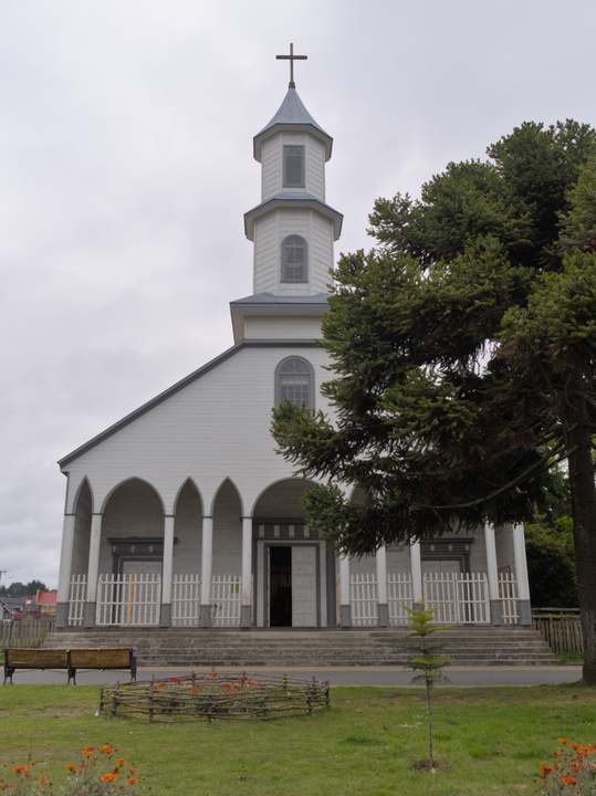
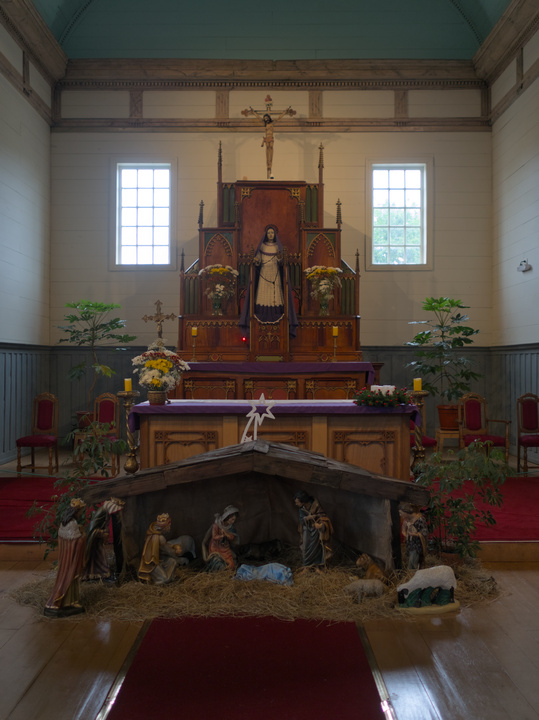
We also visited the Nuestra Señora de los Dolores Church before leaving Dalcahue. The Virgin statues had wool woven clothing, showing the Catholicism strategy of mixing their iconography with local tradition to increase their adoption.
We continued our trip to the Quinchao island, arriving to Curaco de Vélez13 on a bus. We were told by a crafts store seller that the town was mourning a lady that seemed to be very important in the local community, so that we wouldn’t expect a lot to be happening there.
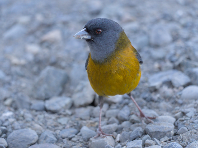
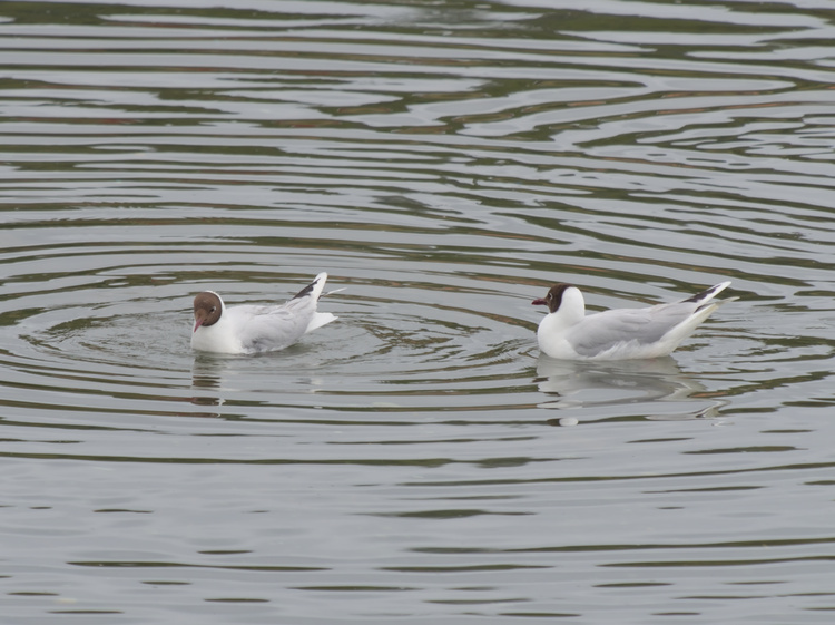
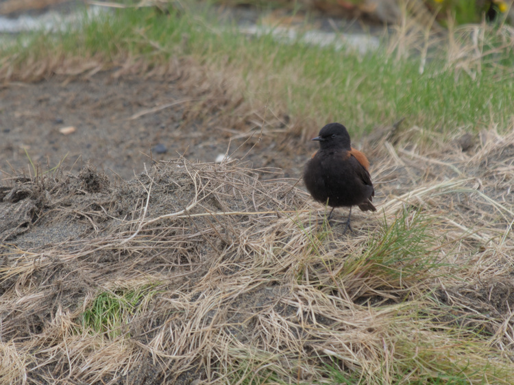
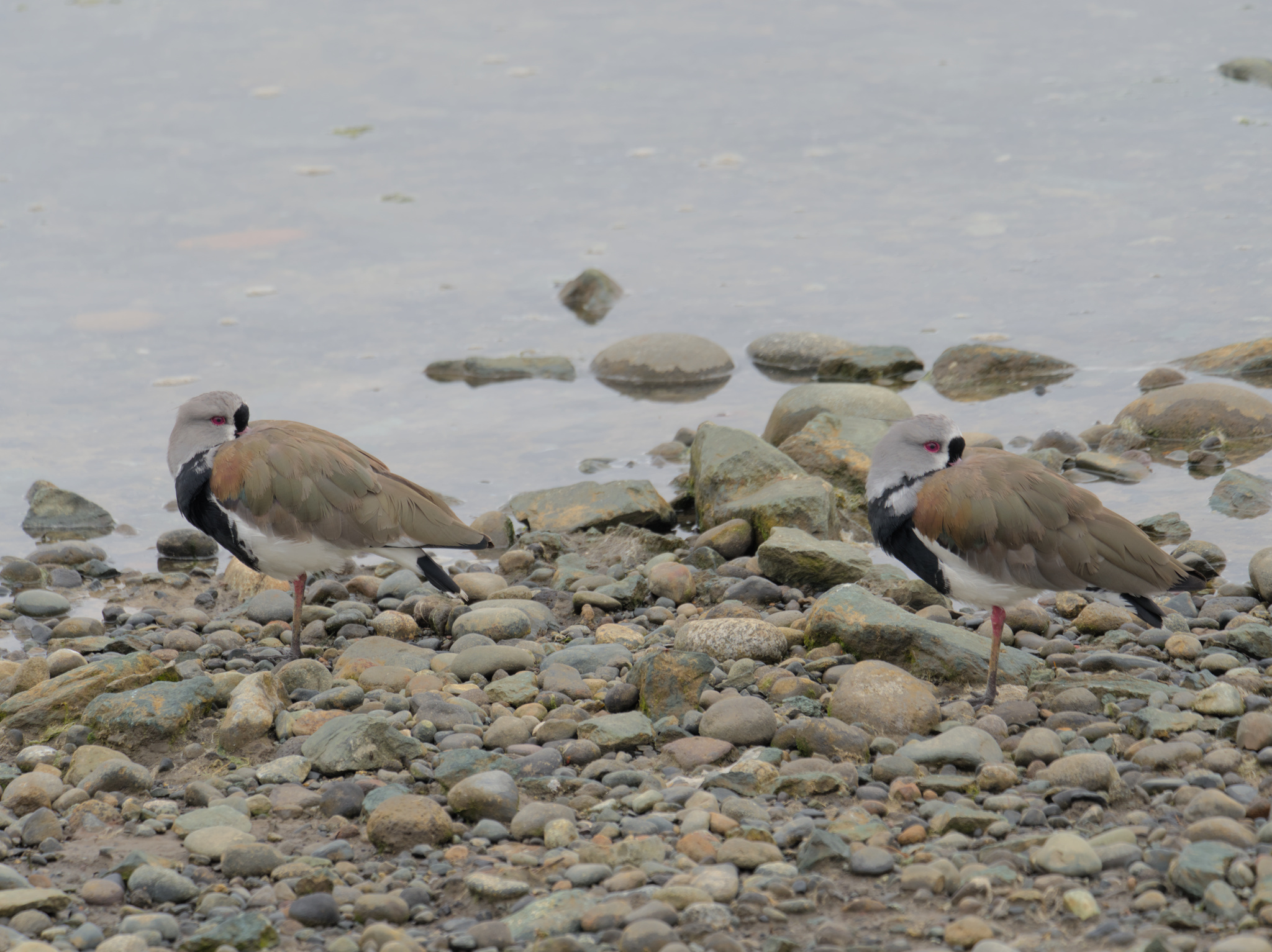
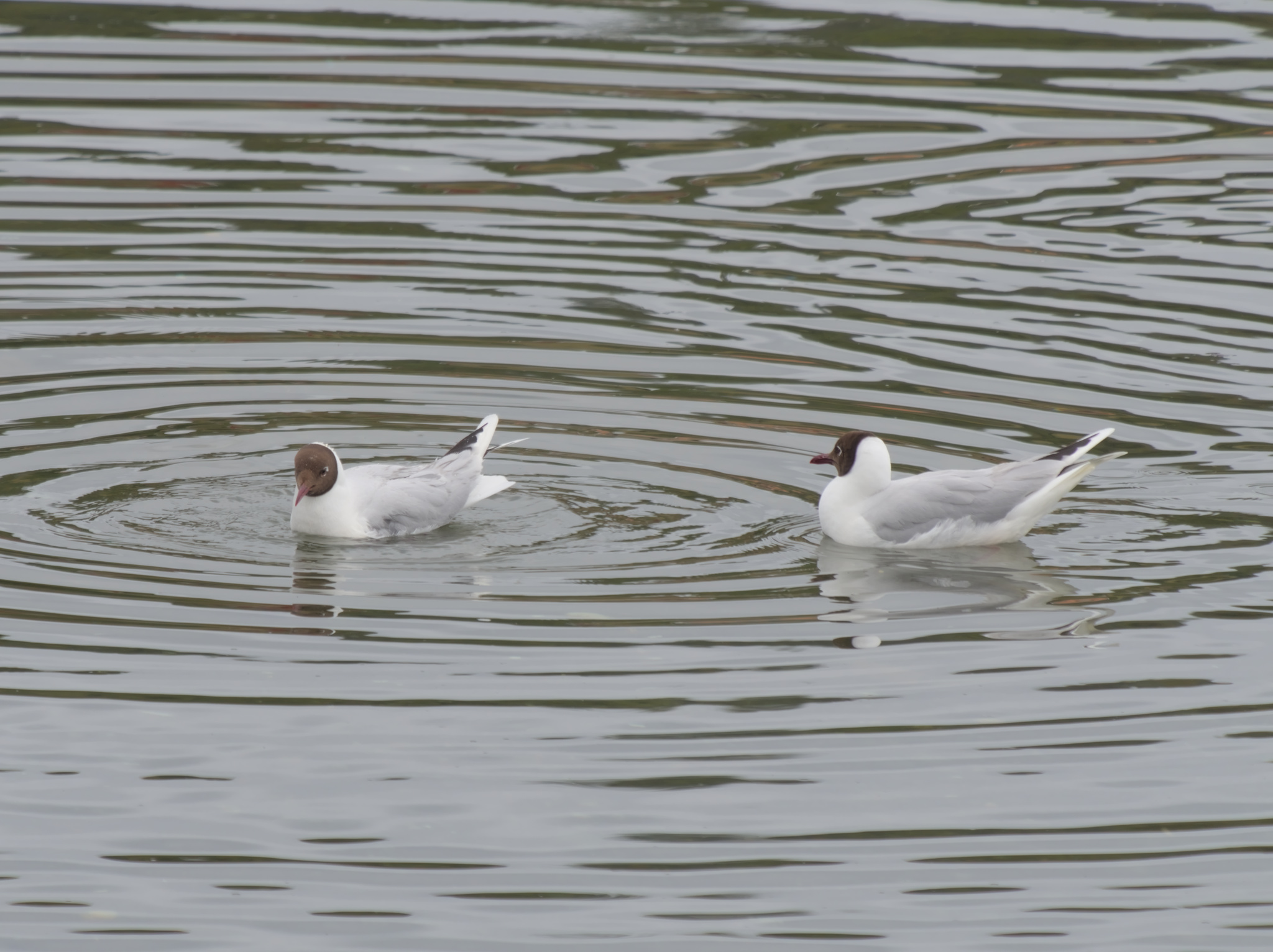
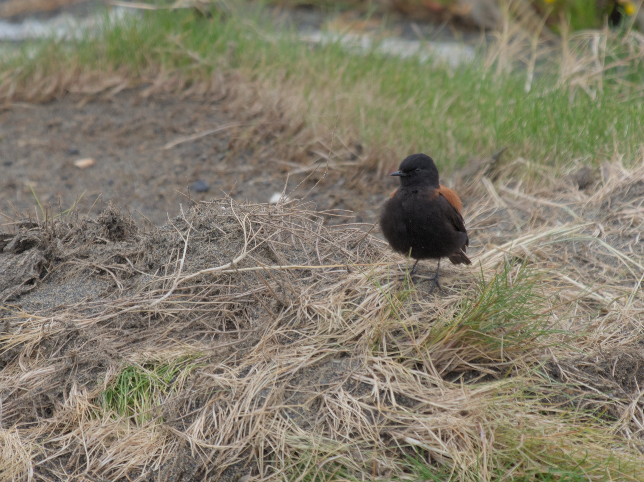
Curaco de Vélez is an important bird watching spot, as their wetlands host a big variety of migratory and resident birds. We saw southern lapwings, brown-hooded gulls, swallows and an austral negrito.

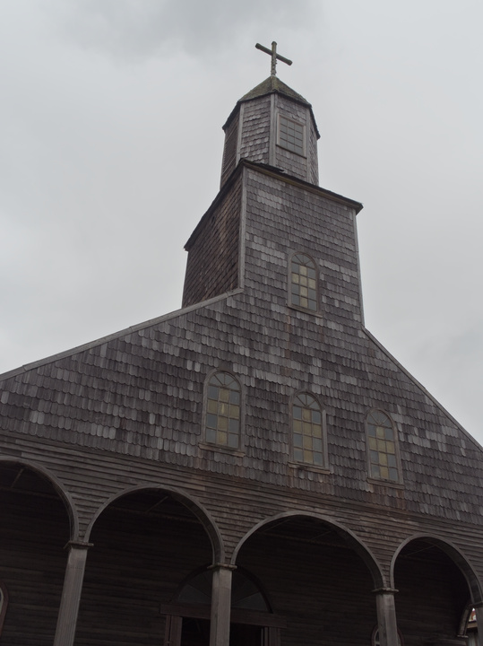
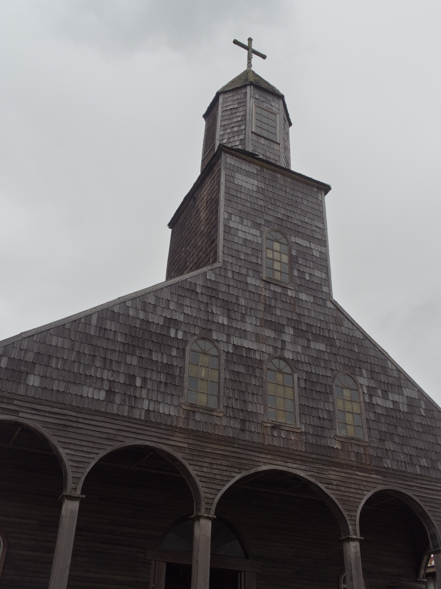
We finished our tour on Quinchao island by visiting Achao14. Its architecture shines by the variety of wood shingles covering the buildings, including Santa María de Loreto church, built in XVIII century. Given the age of the church, you couldn’t use flash to take photos, to avoid cumulative damage.
Before leaving Achao, we went to the Alto La Paloma lookout, where you can see the whole city.
Day 3: Taking the ferry in Quellón
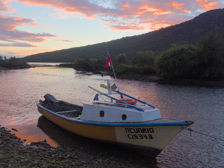
Since we had to be in Quellón15 at 6:30PM to take the ferry to Chaitén, we had to say goodbye to Castro. Once in Quellón, we searched a place to lunch and then we looked through the crafts fair in the main square.
The ferry departed late, but we finally made it back to mainland to continue our trip.
Day 4: Chaitén and Futaleufú
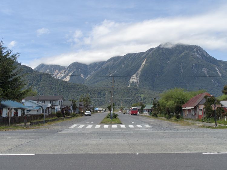
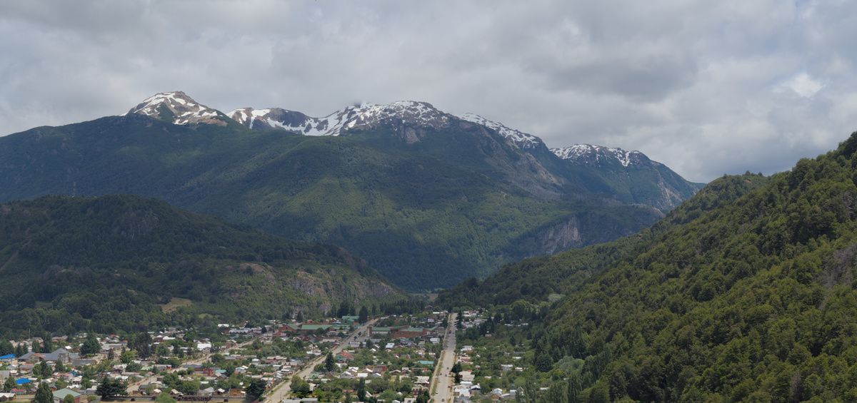
Our main mission in Chaitén16 was to get information about the buses going to Futaleufú17. After we got the information, we strolled in Chaitén for a bit in the time we had left. I was impressed by how near the mountains felt, almost falling over you.
When we arrived to Futaleufú, we went to ask to a tourism agency about rafting, but slots for the next day were filled up. However, as we were walking away, we spotted someone from another agency18 storing their rafts, and after asking him, he gave us a ride to their offices so we could reserve for the next day.
In the agency, we asked for places to stay, but we finally ended up in the Los Coihues camping, on the side of Espolón River.
Day 5: Rafting in Futaleufú
Before going to the rafting trip, we has some time that we used to go to the Water Tower lookout, were you can see the whole town. We passed along Laguna Espejo (Mirror Lake) on our way there.
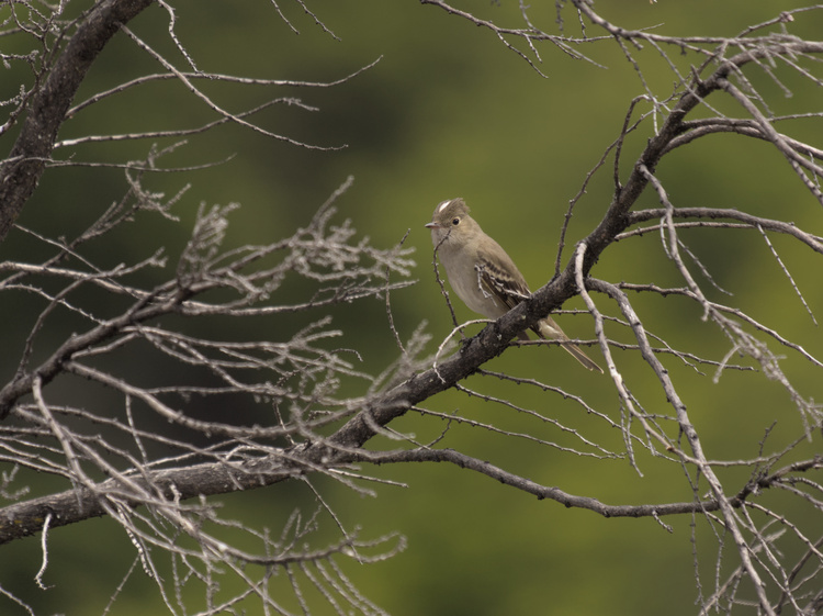
In the middle of the trail there are some stairs that seemed to never end, but the view at the end made the effort totally worth. While we were taking a pause, a white-crested elaenia perched on a nearby tree and flew away in an instant, but luckily I could snap a quick photo.
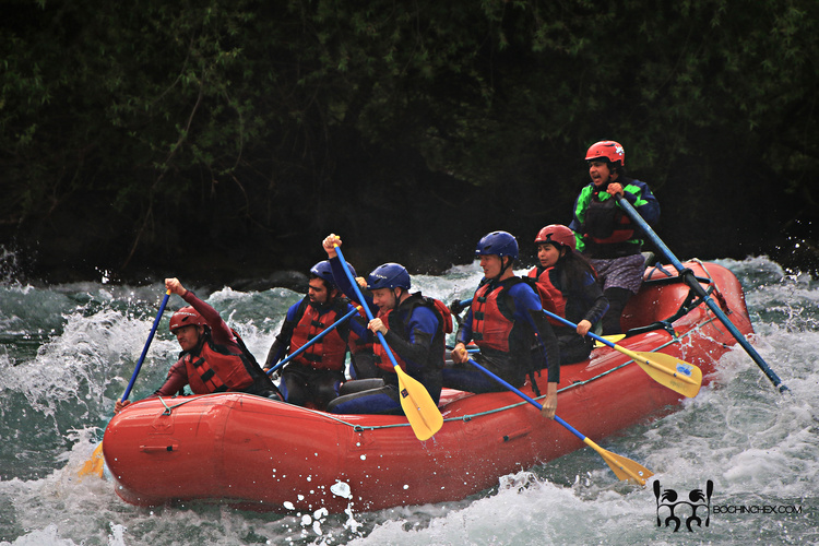
Most traversed white waters on Futaleufú river are class 3 (intermediate) or class 4 (advanced), but our tour included class 5 (expert) white water19. However, our guides took all of the safety measures and we had companion rafts in case anyone fell to the river. Thanks to the charisma of the guide on our raft and the instruction to paddle like our lives depend on that on the harder parts, our descend of Futaleufú river was very memorable and went without any hitch.
At the end of our adventure we had some snacks to recover from our strenous but thrilling adventure.
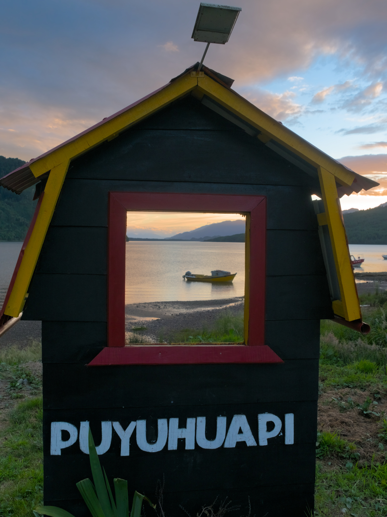
Day 6: Puyuhuapi
To continue our way to the South, we had to return to Chaitén, where we took a bus to Puyuhuapi20, which is half way in the path to Coyhaique.
We stayed at Supermarket and Hostel Valentina. We strolled for a bit in the little bit of day that we had left. We tried to find transportation to the Queulat National Park21, but no one had space left. We also could buy rhubarb jam to bring back home.

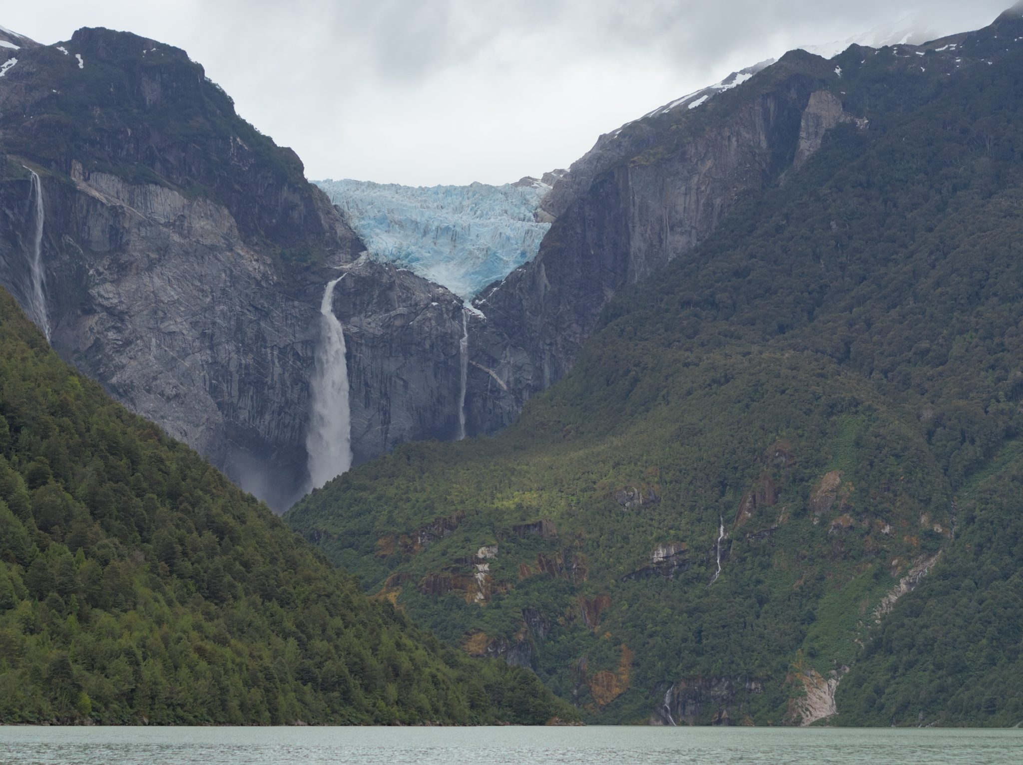
Day 7: Queulat National Park
After looking without luck for a trail near Puyuhuapi that the people recommended to us, we started to walk on the Southern Highway in South direction, hoping that someone could give us a ride to get us closer to Queulat Park. Luckily for us, a young couple that was also headed to the Park took us there.
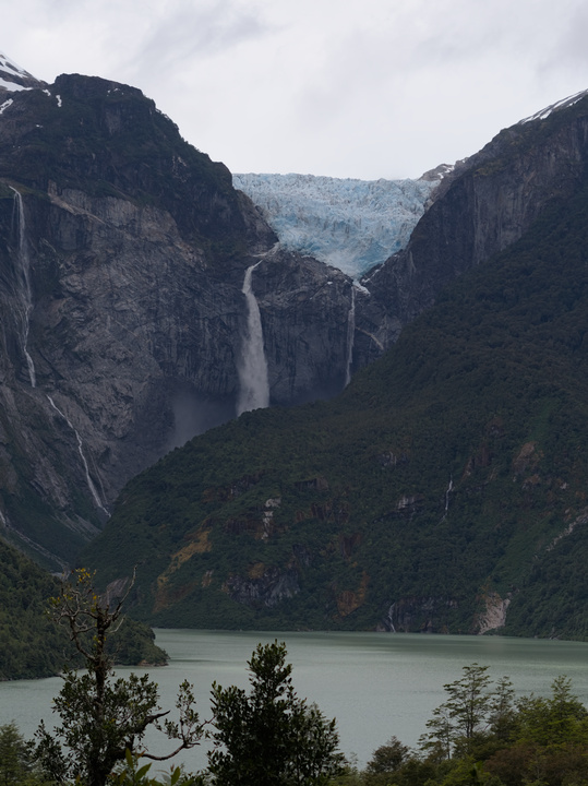
Following the ranger recommendation, we took a newly opened trail. Sadly, only the first half of the trail was open, as the second half was under repairs. However, the lookout at the end of the first half had a very nice view of Ventisquero Colgante (Hanging snowdrift) , the glacier that is one of the main atractions of the park.

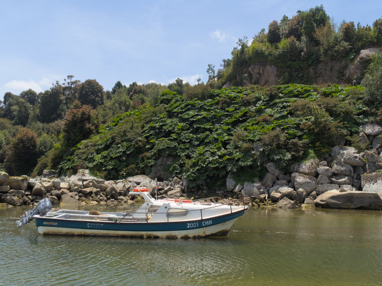
While returning from the first trail, we encountered a Chucao22 that was carrying a handful of worms on its beak, but moved too fast to take a photo of it. We also had the time to walk to Laguna Témpanos, but sadly the boat tours had ended for that day.

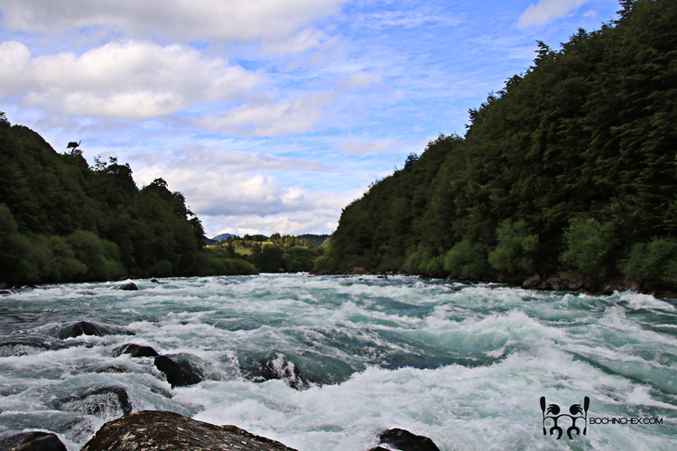
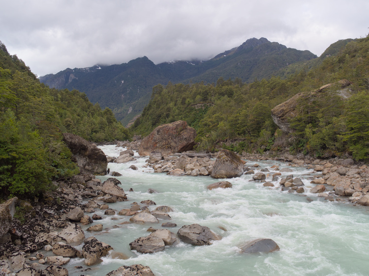
To get there, you have to cross Ventisquero River using a suspension bridge. On our way back, there was a lot of people taking photos of themselves on the bridge, but I just wanted to take a photo of the river itself. To not make people wait, I prepared my camera to take the picture I wanted on the first try.
On the parking lot, we met again with the couple that brought us to the park and they offered to give us a ride back to Puyuhuapi ❤️.
Day 8: Coyhaique
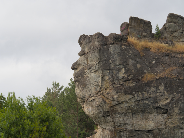
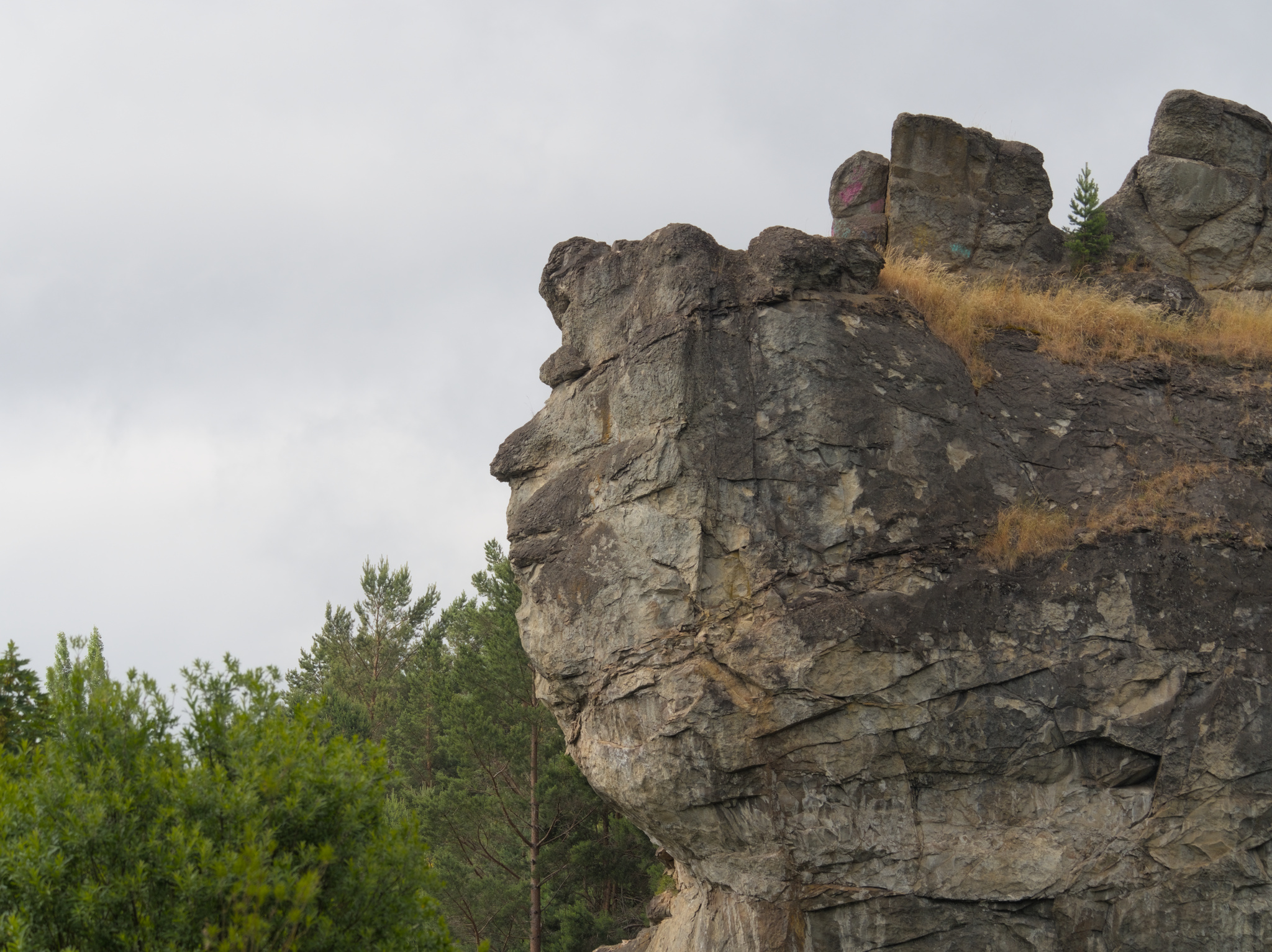
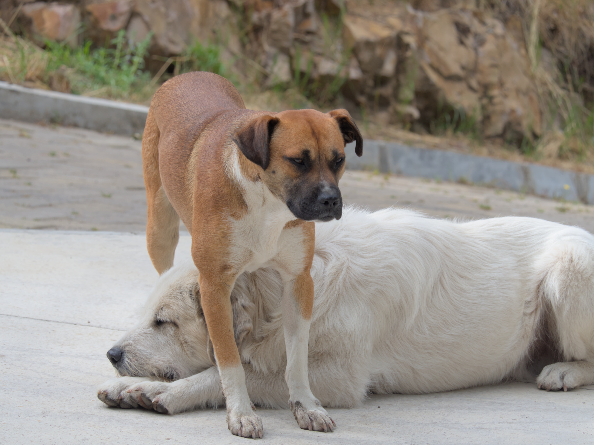
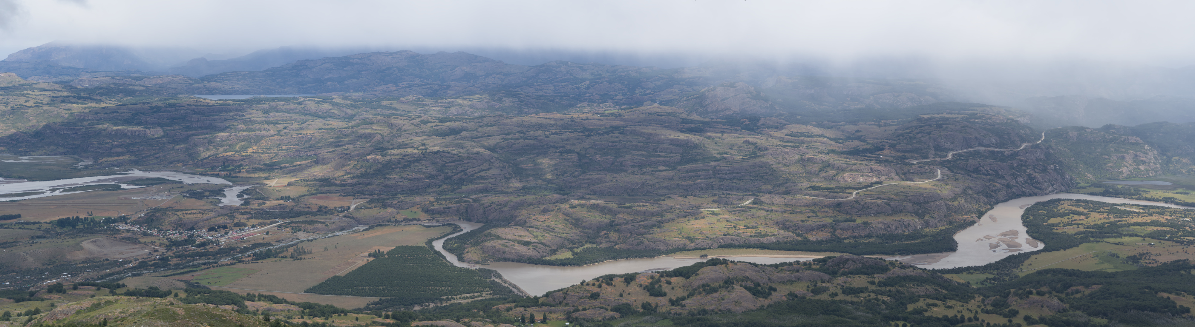
In our walk around Coyhaique23, we strolled around the Simson River Park and went to see the Piedra del Indio (Indian’s Rock). On our way there, two dogs joined our walk, making us company for around 2 kilometers.

We also walked around the main square of Coyhaique, which is particularly pentagon shaped. Looking for activities for the next day, a tour to Cerro Castillo24 quickly became the winner, but we were not finding a way to only go for the day, even after looking for information in the Tourism office. Finally, we found an ad in the street, so after contacting the number we finally had transportation.
Day 9: Cerro Castillo
Just before going out in the morning, we realized I left our keys inside our locked room. As the hostel didn’t have any copies, I started to panic a bit, but we remembered that we had left the window open, so the owners could retrieve the keys.
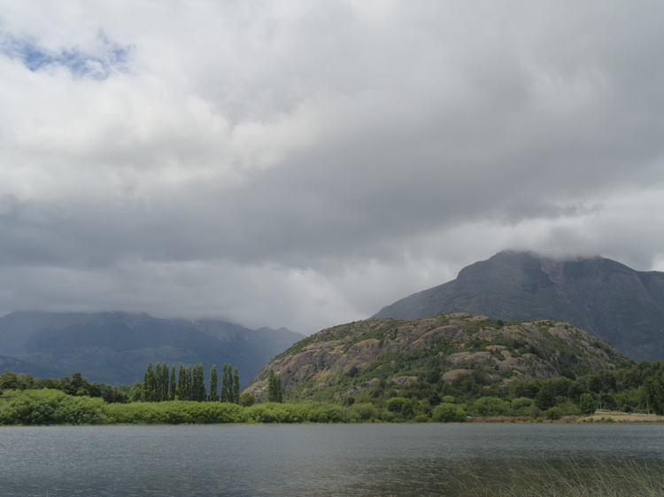
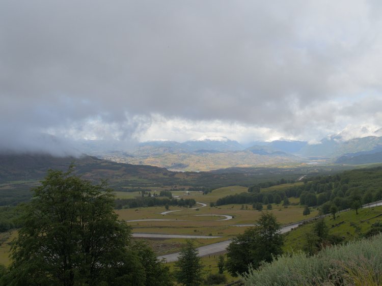
The van that took us to Cerro Castillo mainly does tours to Laguna San Rafael, but it had some free seats and our destination is on the way there. We did a few stops in some notable places on the way, while the driver was telling us about the microclimate that forms in those mountains. We could take photos of Laguna Chiguay and the Cuesta del Diablo (Devil’s Slope).
The driver also gave us some breakfast, so I took some pan de pascua. Once in Villa Cerro Castillo, we started our hike.

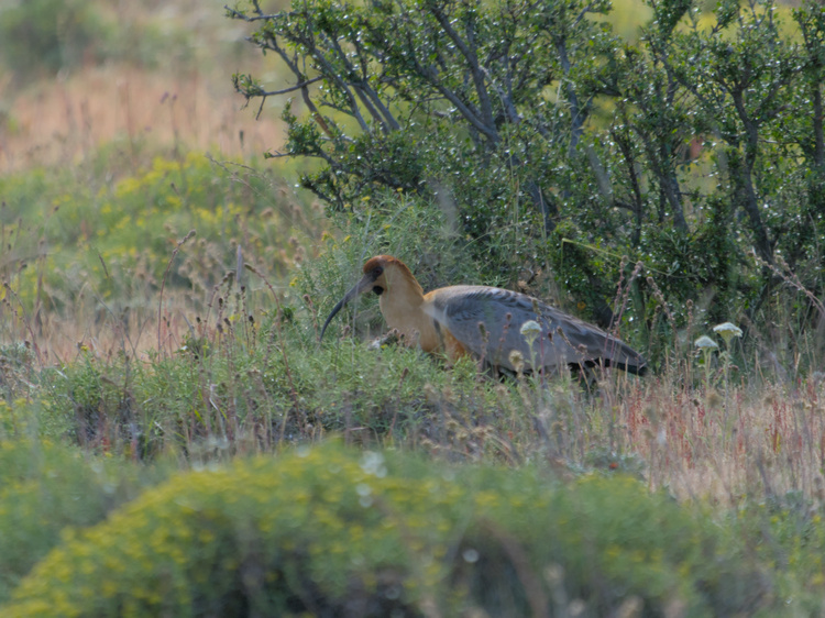
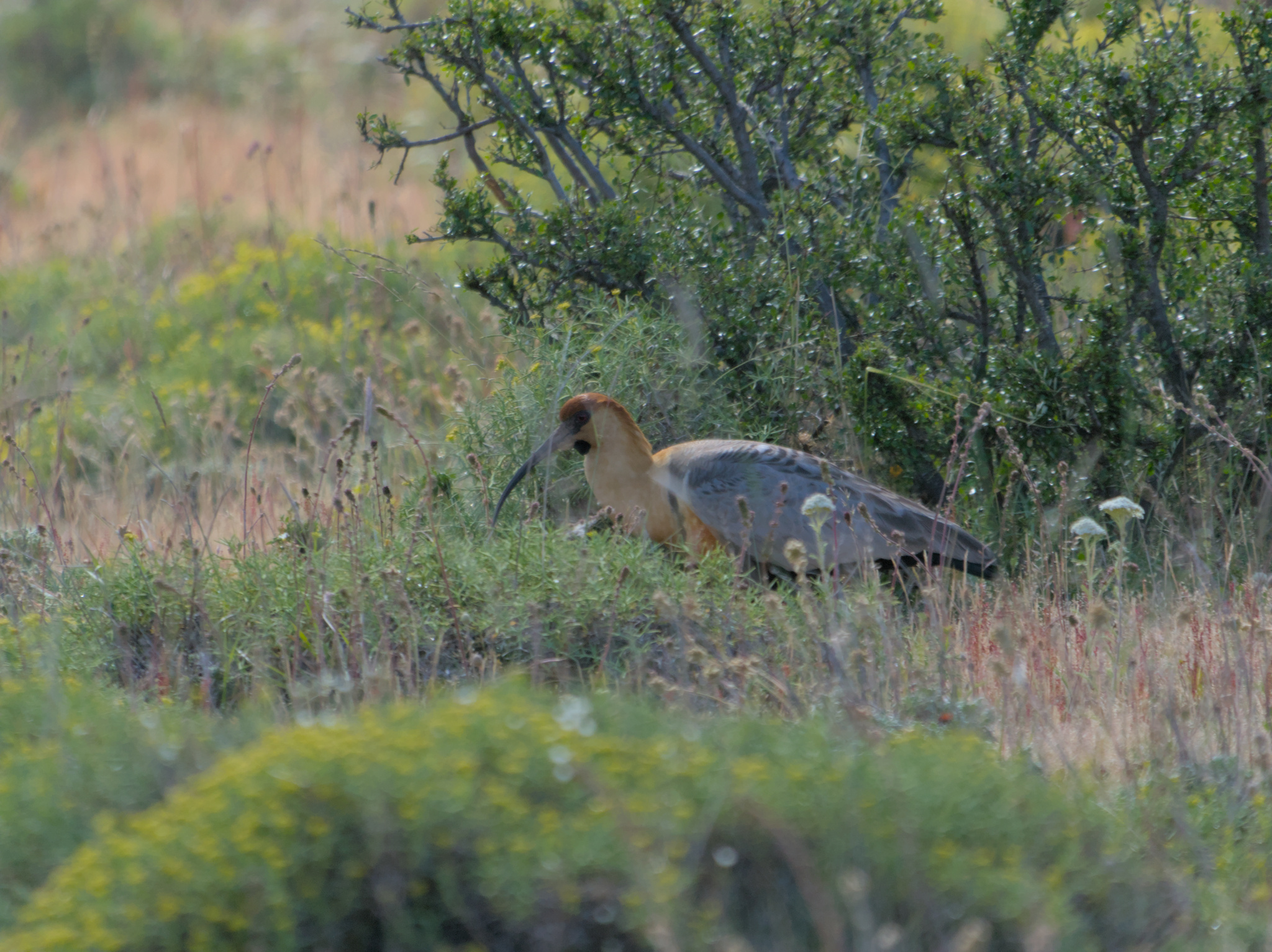
The shortest trail in Cerro Castillo starts in private property, but the ticket booth was closed. A woman that was walking before us just jumped the fence, so we just followed the example. Another foreign tourist joined us in jumping the fence, but we lost him quickly, as he walked a lot faster than us. Shortly after starting the trail, we encountered a few black-faced ibises, which we took some time to photograph.
It seems that we took a wrong bifurcation on our way up, as we ended up facing a herd of cows. Once we entered the National Park, weather took a dramatic turn. Coldness, wind and even hail stormed intermittently, but intensely.
As it was getting late, and all of the people that we met on their way down commented that the weather didn’t got any better up there, we decided to stop at 1200 meter above sea level to rest a bit before returning.

With this view, our Southern adventure ends, in which we escaped the heat of over 30°C that went down in Santiago.